QGIS (GIS Software)
Overview and Setup
QGIS is a free, open-source desktop Geographic Information System (GIS) software that allows users to visualize, edit, analyze, and publish spatial data. It provides a robust platform for mapping and geospatial analysis.
To access the OOD web portal, please refer to our Getting Started with Open OnDemand documentation page. Once logged into the portal, you can launch QGIS from under the GIS Software header.
Configuring QGIS
To get started, connect to OOD and choose QGIS from the GIS Software header.
In the submission form, you can choose the account, partition, the length of your job, the number of cores you need, and the node type.
Note
- For account, put whatever group account you’re associated with. If you do not have a group account, use free.
- The partition is always ood
- Node type is any
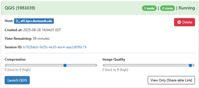
After you click “Launch”, a new session will be queued. Once the session is active your page will appear as follows:
When launching QGIS, you’ll notice two key sliders: compression and image quality. These settings can greatly affect your overall experience. To optimize performance, we suggest cranking up the image quality slider to the highest setting (9). If you’re not satisfied with the result, it’s easy to close the tab, adjust the sliders, and start again. Experimentation is key to finding the perfect balance between performance and visual quality for your environment.
Using QGIS
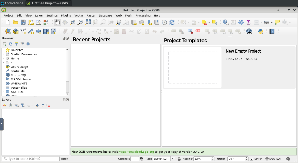
Click on “Launch QGIS” to begin using QGIS. Once you have entered your session, you should see the QGIS page below:
This is a typical QGIS interface that should be familiar to frequent users.


